AGTMap · Land intelligence
A straight answer on any piece of land.
119 sources, land records across 16 states and union territories, and a score that will not guess when it does not know.
Is this plot worth a site visit for a warehouse?
- 1
Survey 412/2 · 4.21 acres
Two owners on record. Water at 18 m. No record of dues, so worth asking the seller.
- 2
Industrial zone · warehousing allowed
The city plan allows it here, with floor space up to 1.8 times the plot.
- 3
No flood since 1998
Twenty-five years of flood maps. None reached this plot.
- 4
Substation 1.2 km away
Close enough to connect without building a new line.
- 5
140 m on the state highway
Trucks reach the gate without a village road.
The problem
Every parcel needs a verdict. Getting one takes months.
Buyers get parcels in bulk from broker networks. The data that decides each one is scattered across portals, departments and surveys that were never designed to be read together, so the decision defaults to a consultant, or to instinct.
- Land parcels in India
- 0M+
- To reach one verdict
- 0-3 months
- Across portals & departments
- Fragmented
Land parcels in India
Behind $100B+ in annual real-estate transactions.
To reach one verdict
Per parcel, through consultants and field visits.
Across portals & departments
Revenue, planning, environment, hazard, utilities. None of them talk.
Time to a verdict
Consultants & field visits1 parcel
2-3 months
AGT Map1,000 parcels
Minutes
Same decision. Roughly 70% of the screening work removed, so survey spend goes only to land that already qualifies.
How it works
From fragmented land data to a scored verdict.
01
Gather
We pull everything known about that exact piece of land: records, satellite pictures, city plans, flood history, water, roads.
119 sources · 16 states and UTs
119 layers pulled against the parcel, not its address
02
Cross-check
Sources disagree all the time. We show you where they do instead of quietly picking one.
Every source checked against the others
Agreement raises confidence. Disagreement becomes a flag.
03
Answer
A clear yes, maybe or no, with the reasons that pulled the score down, and where each number came from.
Scored for what you plan to do with it
A scored go / no-go, with the flags that capped it.
The old way
Two to three months of consultants and field visits, per parcel.
The AGT way
A decision you can act on, at a fraction of the time and cost, and 1,000 parcels pre-screened in the time one used to take.
Watch it work
One real question, answered step by step.
agtmap.com / workspace
You asked
- press replay to run the screen
Score for
scorecard v4
Moderate
Worth a site visit, with two conditions to clear first.
- Title clarity68×0.35
- Physical suitability86×0.20
- Risk79×0.20
- Connectivity & growth91×0.20
- Water54×0.05
- Encumbrance certificate not on file. Title scored provisionally, capped at 60 until an EC is read.
- Parcel sits in a semi-critical groundwater block; a borewell will need CGWA permission.
Illustrative run on a representative parcel. Every figure in a live report carries its source and read date.
Run it on your own parcelWhat a verdict covers
Sixteen questions every buyer asks. Answered for your exact plot.
Not the postal address. Not the neighbourhood. The exact boundary you are buying, so a corner that crosses into protected land shows up now, not later.
How it checks
What happens after you ask.
AI on its own makes up places. Here, everything it says has to be true of the actual plot.
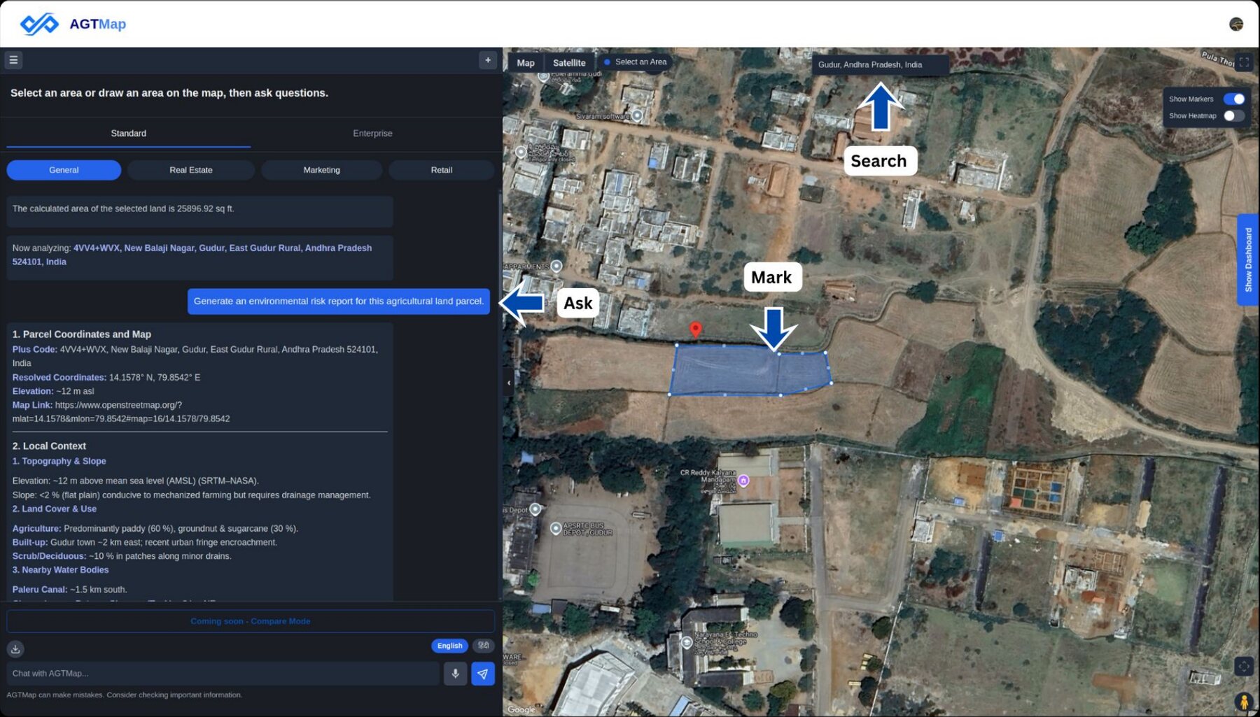
The workspace
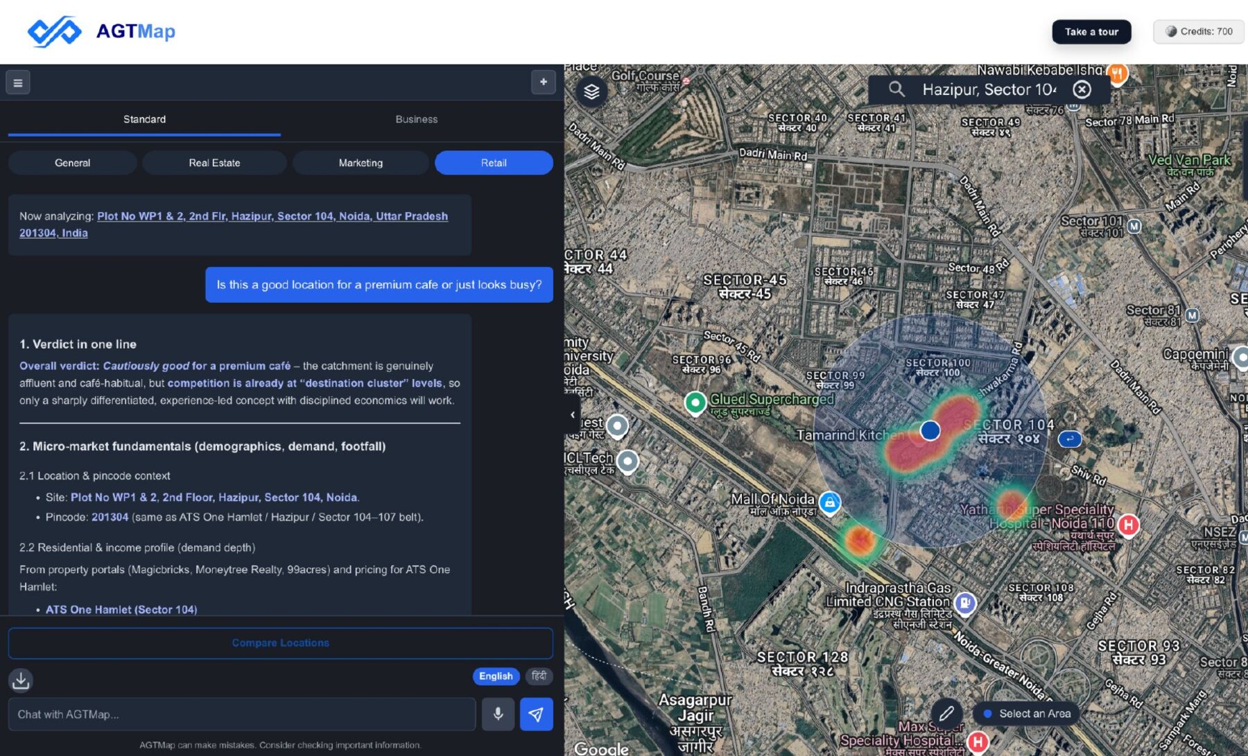
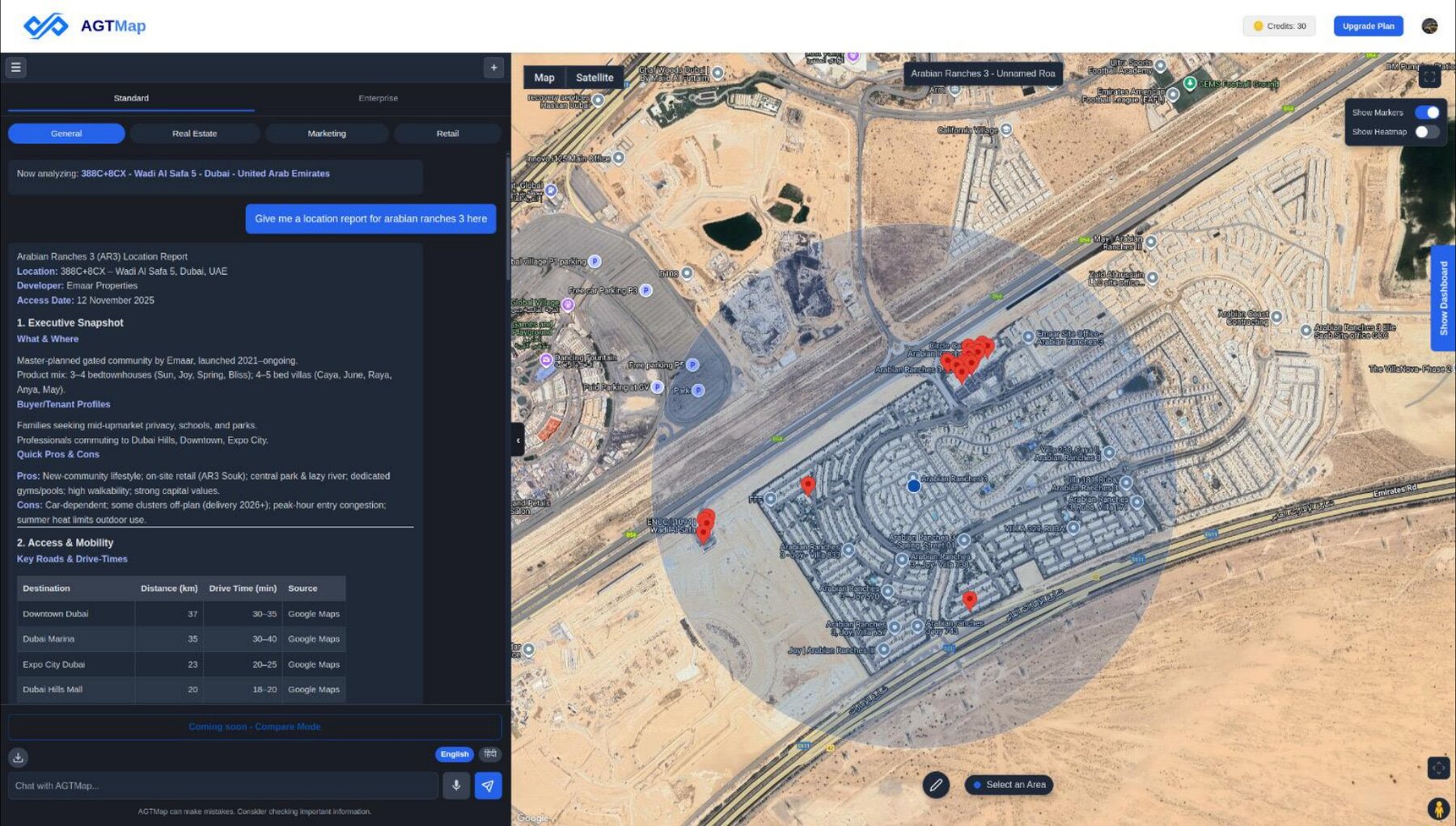
Draw the plot. Ask your question. Read the answer on the map.
Ask the way you would ask a person. You get the answer on the map, with the land it looked at highlighted.
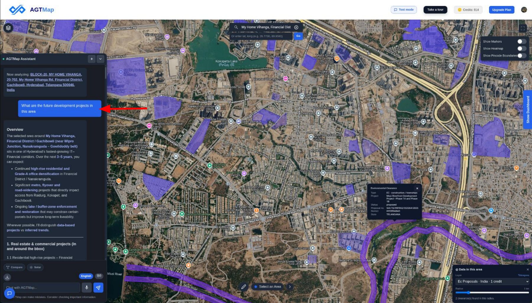
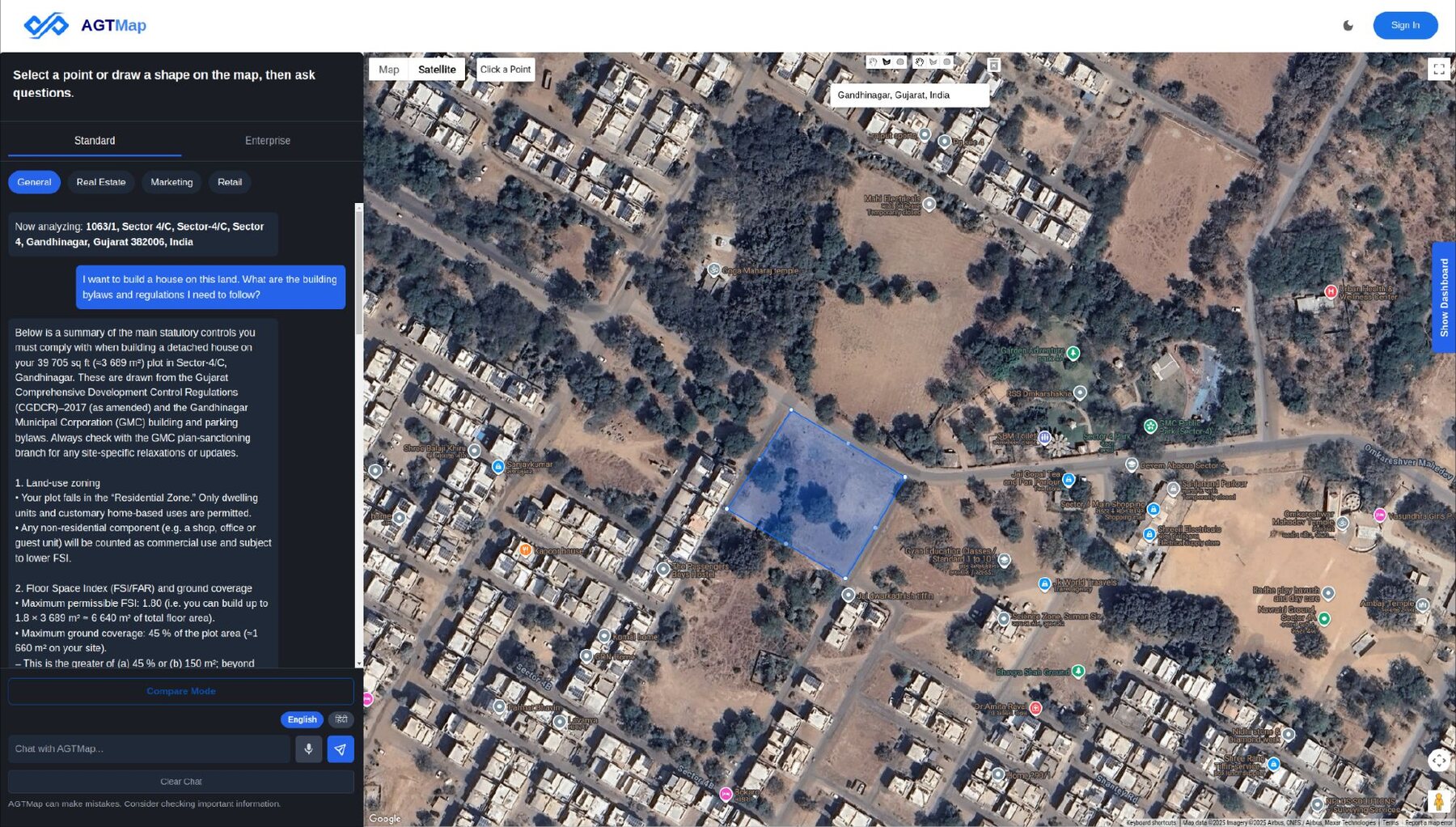
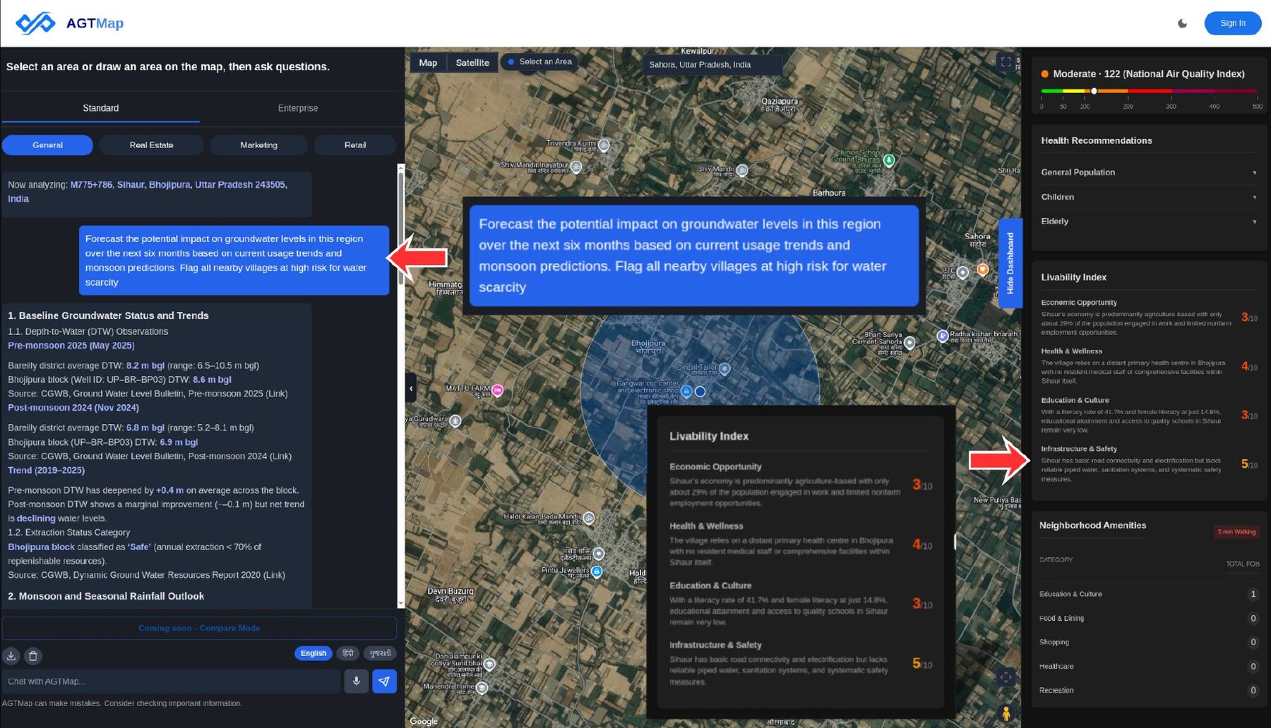
Anatomy of a verdict
Five things we score, weighted for your plan.
The same plot is a different deal for a farmhouse, an investment and a hotel.
Agri / farmhouse
scorecard v4- Title clarity30%
- Physical suitability20%
- Risk20%
- Connectivity & growth15%
- Water15%
Urban land bank
scorecard v4- Title clarity35%
- Physical suitability20%
- Risk20%
- Connectivity & growth20%
- Water5%
Hospitality site
scorecard v4- Title clarity15%
- Physical suitability15%
- Risk20%
- Connectivity & growth35%
- Water15%
Title clarity
Record of rights and encumbrance. Left unscored, never guessed, when no EC exists.
Physical suitability
Terrain, soil, shape and frontage. Will the ground carry what you intend?
Risk
Flood history, seismic zone and protected-area overlap. Can cap the whole verdict.
Connectivity & growth
Road, rail, grid and network reach, plus a decade of night-lights momentum.
Water
Groundwater depth, prospects and quality. Surface water and drainage.
Strong
80-100
Go ahead. Worth paying for a survey.
Moderate
60-79
Worth a visit, with things to sort out first.
Caution
40-59
Only if you have a very good reason.
Some findings cap the band outright, and title is left unscored, never assumed clean, when the record of dues and claims is missing.
Where numbers come from
Every number tells you where it came from.
Six months later, someone will ask where a number came from. You need to be able to answer.
Every number names its source
If we cannot say where it came from, we do not show it.
Missing means missing
A record we could not read is never shown as a clean one.
Disagreements stay visible
You see both sides. We never quietly pick one.
One serious problem caps the score
Overlap protected land and the answer stays cautious, however good the rest looks.
The full catalogue is in Data & Coverage, and how to call it from your own systems is in API & MCP.
Those show you where something is. We tell you whether to put money into it. We take that location data and add the plot boundary, what the city plan allows, flood and hazard, what is nearby and who wants to be there, then score it for what you plan to do.
State revenue departments and the record-of-rights systems, wherever they have been digitised. Coverage varies by state, and the report says so explicitly: a parcel with no digitised record is reported as unscored on title, never as clean.
The disagreement is surfaced as a flag with both sources attached. We do not average conflicting values into a single confident-looking number, because that is exactly how a diligence file becomes unusable in an audit.
No. It is the screen that runs before it. AGT tells you which parcels deserve a lawyer, a valuer and a site visit, and removes roughly 70% of the ones that do not.
Yes. Bulk screening takes a list of parcels or geometries, and enterprise deployments can run against your own data alongside ours. Talk to us about what your environment requires.
India is the main market, with plot boundaries across 16 states and union territories, and everything else covering the whole country. We also work in the Gulf. Anywhere else, just ask.
Bring us a parcel you already know the answer to.
Run it on land you have already checked yourself. See whether it agrees with you, and whether it spots what you spotted.